« Bungie's New Home | Main | Insanity is Hereditary... »
March 28, 2005
Las Vegas to Death Valley
I was in Las Vegas 10 days ago for a hockey tournament, and I had a spare afternoon -- my flight landed at 2 pm, and our first hockey game wasn't until midnight (they run these tournaments almost 24 hours due to lack of ice rinks).
As it happened I had read an article in the paper the previous weekend about how the record rainfall was affecting Death Valley -- causing flowers to bloom in unprecedented numbers. I'm always a sucker for quotes like "Hey, you may not see it this good again in your lifetime".
So, before my flight left from the airport in Seattle I called Hertz, and when I landed in Vegas I picked up my car and immediately headed west.
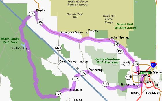
Although Death Valley is one state over, it's not really that far. Since sunset was around 6 pm and the newspaper had said the best flowers were in the southern parts of the park, I headed west on highway 160 to Pahrump, then on 372/178 through Shoshone and into the park.
It's about 100 miles to the park entrance, but the roads are pretty empty and you can blast along at 80 miles an hour most of the way (except when first leaving Las Vegas). The road to Pahrump, which is deserted, has been thoughtfully turned into a four lane road by the Nevada DOT. Far be it from me to speculate, but it is true that Pahrump is just over the border in Nye County, which means bordellos are legal there. So perhaps the highway was widened to allow people to get to their "dates" just a bit faster?
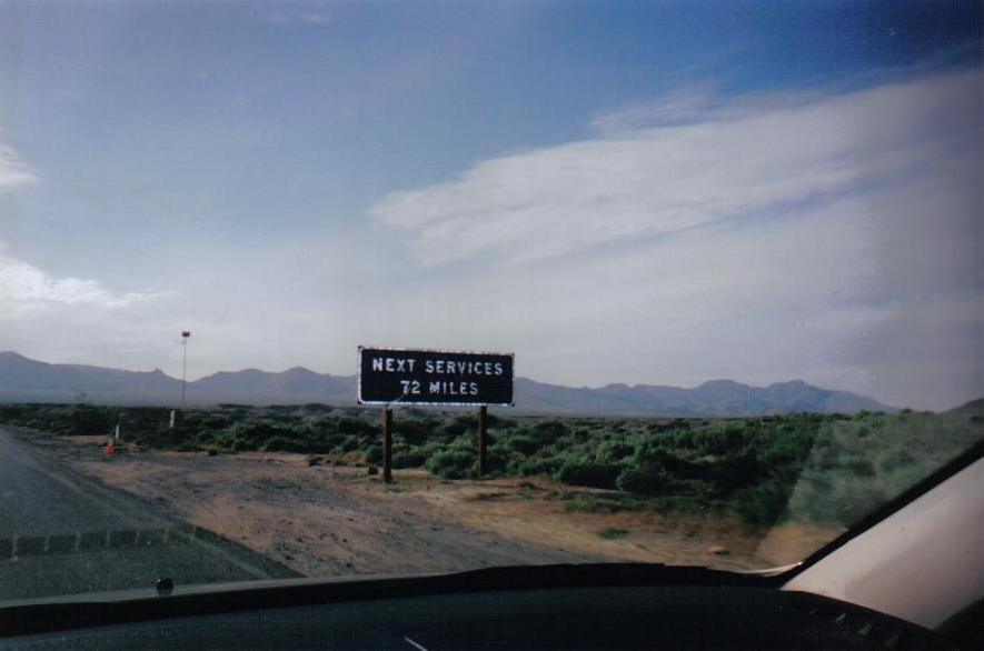
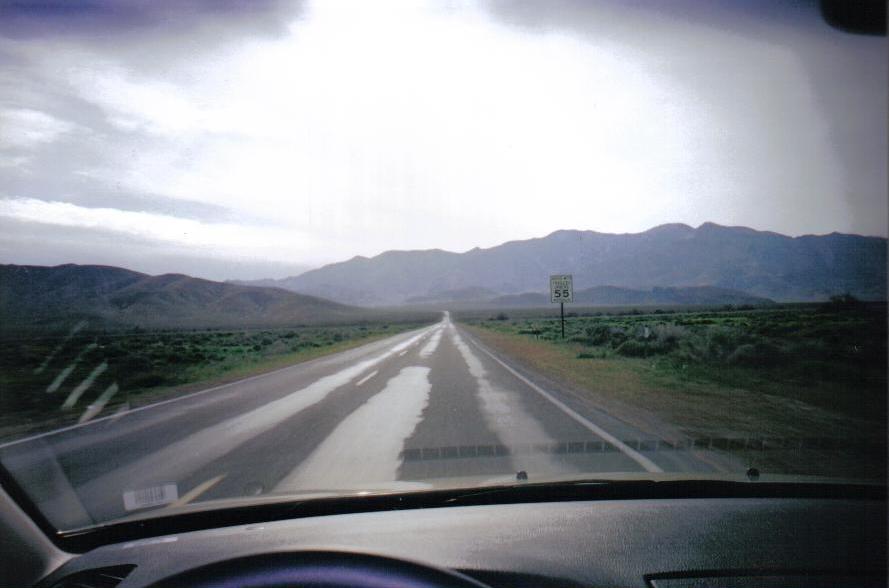
In any case, you do get to Pahrump, then after missing the turn off for 372 the first time, you wind up on a truly deserted road, leaving you to ponder the strangeness of experiencing such solitude in the middle of a Las Vegas vacation.
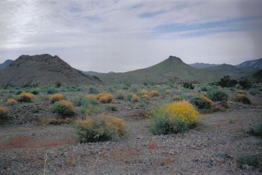
Once you get to the park, as promised, you see some excellent floral displays. I had never been to Death Valley before, but it's usually just scrub desert, not scrub desert with millions of flowers.
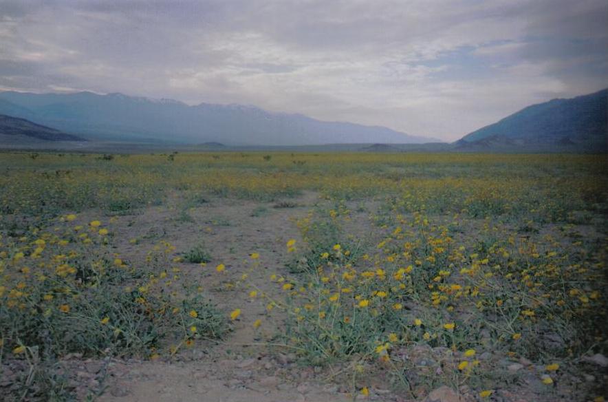
At first I was just seeing lots of individual flowers, but then as I got a bit further north, there were some incredible vistas where entire fields or hillsides were yellow from the flowers (the photo below is from the west side of Jubilee Pass, just like the article said). I gather that these are normally plain brown and green. The flowers are so cool that you forget how stunning the scenery behind them is. There were lots of cars stopped at the side of the road with people staring ga-ga-like, and also several photographers with fancy cameras on tripods. So I predict in a little while you will be able to buy some nice photos of Death Valley in bloom.
Hertz had thoughtfully provided me with a zippy little Mazda 6, which was an invigorating companion on the park road (the road is paved, but it's one of those where they didn't spend a lot of time smoothing out the ground underneath, so there tend to be lots of nice ups and downs).
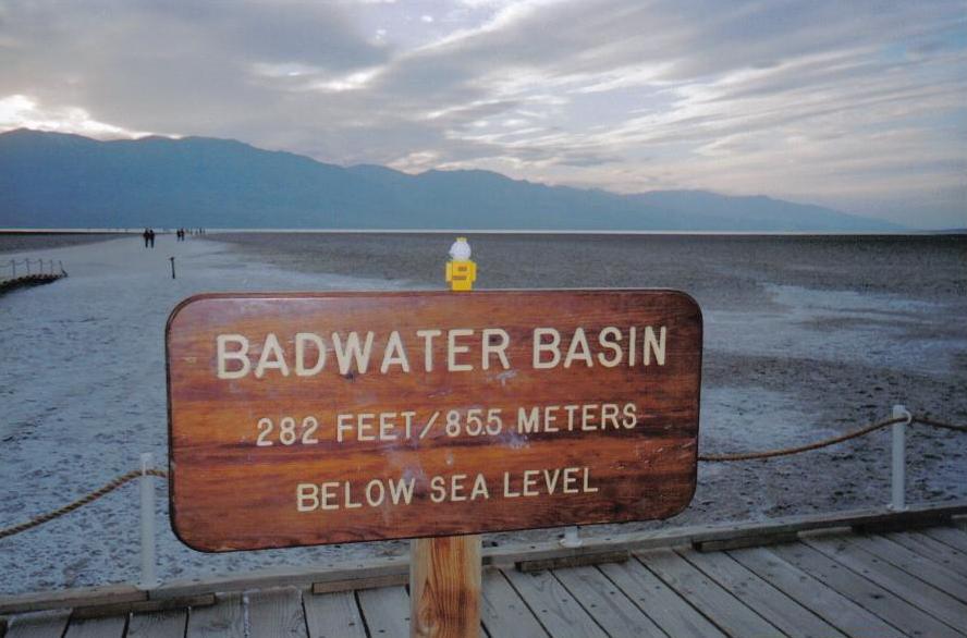
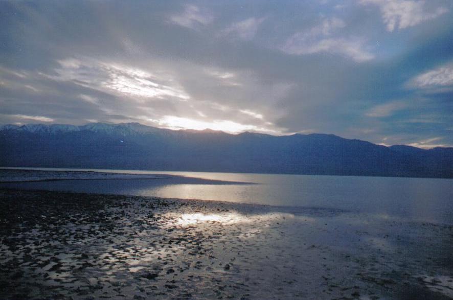 At 143 miles from the Las Vegas airport, 2 1/2 hours after I left (including various stops for photos along the way), I reached Badwater, the lowest point in North America.
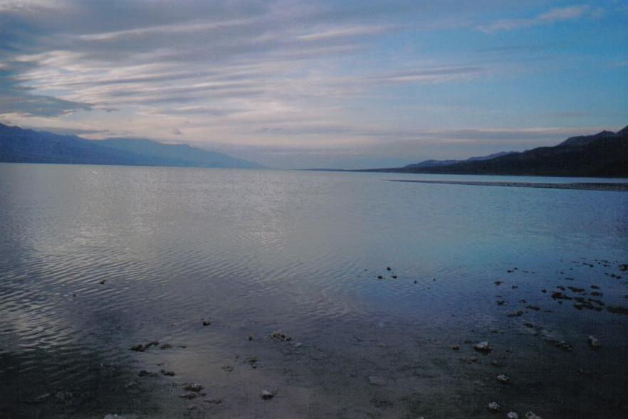
As promised, there was a giant lake there. I got a nice photo of the sun setting over Telescope Peak, the highest point in the park. Where the lake is there is normally wierd dried salt formations; right at the lowest point there is a sign indicating a small pond that is usually the only water around. There is no place for the water to flow away from Badwater (which I guess makes sense since any place it exited to would need to be lower), but normally Death Valley is so hot that almost all the water evaporates.
At 143 miles from the Las Vegas airport, 2 1/2 hours after I left (including various stops for photos along the way), I reached Badwater, the lowest point in North America.
As promised, there was a giant lake there. I got a nice photo of the sun setting over Telescope Peak, the highest point in the park. Where the lake is there is normally wierd dried salt formations; right at the lowest point there is a sign indicating a small pond that is usually the only water around. There is no place for the water to flow away from Badwater (which I guess makes sense since any place it exited to would need to be lower), but normally Death Valley is so hot that almost all the water evaporates.
Badwater has a small boardwalk and then a path you can follow that leads to the salt formations (or the lake, in this case). You can walk to the edge of the lake, but with the water there it was more like a gradual transition from terra firma to spongier and spongier ground.
From Badwater I drove north to Furnace Creek, where the visitor's center is. I arrived 15 minutes after it closed, so I could not pick up a pamphlet (which has one of those excellent maps [warning: slow-loading PDF link]). The way I drove it was 160 miles from the LV airport to Furnace Creek. I was planning to drive east on 190 to Death Valley Junction on my way back, but discovered that the road has been washed out due to a storm; instead as the light faded I drove north towards highway 374 and the town of Beatty, NV. Now I was back on US 95, the main line from Reno to Las Vegas, although at night it was just another two-lane road, where I could drive for 20 minutes without overtaking another car. I drove on through Amargosa Valley, aware that Yucca Mountain was slumbering to my left, and beyond that Area 51. Eventually the road widened to four lanes, and it was a straight shot back to Vegas, 155 miles from Furnace Creek via the northern route.
Posted by AdamBa at March 28, 2005 09:12 PM
Trackback Pings
TrackBack URL for this entry:
http://proudlyserving.com/cgi-bin/mt-tb.cgi/181